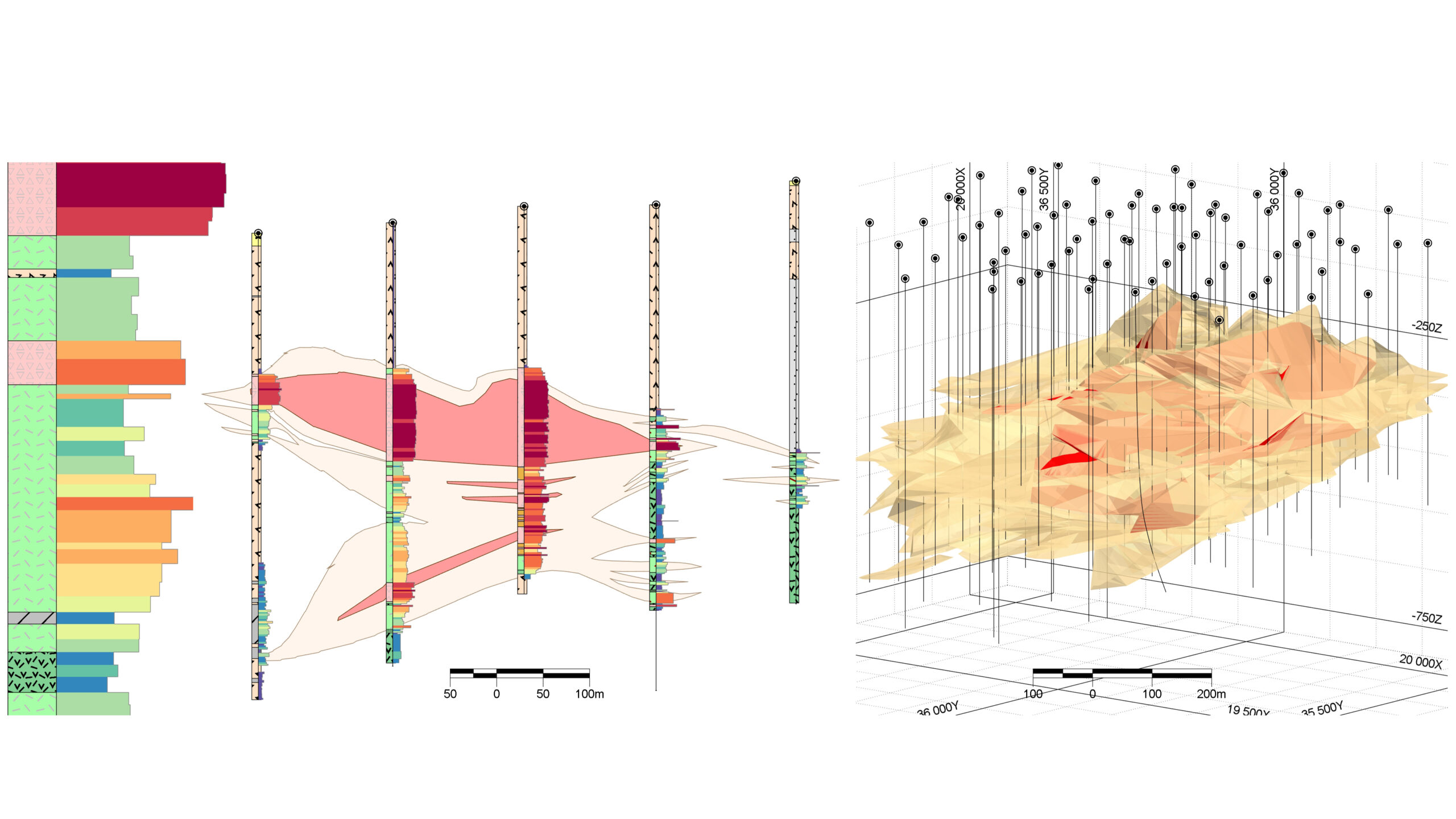
Geospatial integration of different types of geological data using Micromine Origin & Beyond
18th International Scientific Conference “Monitoring of Geological Hazards and State of the Environment” (14-17 April, 2025, Kyiv). Conference paper
Comprehensive geological researches, icluding the modelling of geological objects and processes, utilize various types of data, including geophysical, geochemical, mineralogical, petrological (lithological), stratigraphic, topographic, hydrogeological, environmental, remote sensing and others.
These data can be historical or current, quantitative or qualitative, and obtained through drilling, surveying, measurements, laboratory testing, or other operations.
The article discusses the integration of different geological data used in complex geological studies.
Data usually have different sources, file formats, coordinate systems, and can be one-, two-, or threedimensional. An overview of modern tools and features for integrating different types of geospatial data is provided for Micromine Origin & Beyond, which helps to improve workflows and reduce data errors.